 vesseltracker.com
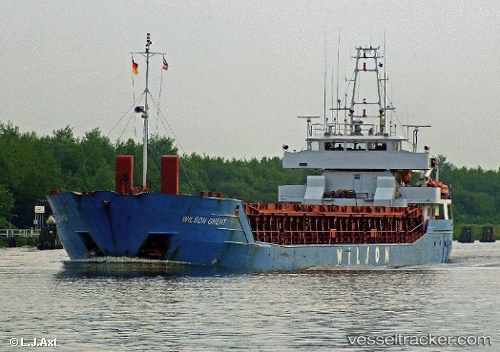
Vessel Wilson Ghent IMO: 9150236, MMSI: 314548000 General Cargo Ship
UTC, 59.23013, -1.32650, course: 242, speed: 9.6
UTC, 59.01852, -1.98593, course: 233, speed: 9.5
2026-02-18 03:45:03 UTC, 58.86861, -2.43886, course: 230, speed: 8.9
Live AIS position:
UTC. 13 nm S of Lamb Head),
updated 2026-02-18 03:45:03 UTC.
Find the position of the vessel Wilson Ghent on the map. The latter are known coordinates and path.
marine traffic ship tracker show on live map
The current position of vessel Wilson Ghent is 58.86861 lat / -2.43886 lng. Updated: 2026-02-18 03:45:03 UTCCurrently sailing under the flag of Barbados
Details:
Last coordinates of the vessel:
UTC, 59.36103, -0.93790, course: 243, speed: 8.5UTC, 59.23013, -1.32650, course: 242, speed: 9.6
UTC, 59.01852, -1.98593, course: 233, speed: 9.5
2026-02-18 03:45:03 UTC, 58.86861, -2.43886, course: 230, speed: 8.9